Conference Programme 2025
2025 Conference Programme
The MARELEC conference offers a unique chance for delegates from academic, industry, experimental and military backgrounds to meet. Cutting edge technologies and developments are presented by leading scientists, engineers and academics in the various disciplines of geophysics, geotechnical engineering, oceanography and naval warfare.
Presentations are supported by an exhibition and poster programme, which offers the opportunity to discuss and strengthen the international network of marine electromagnetics.
9.45
Introduction and welcome from the Conference Chair
Madeline Dana Lee, Research Scientist, SINTEF, Norway
PLENARY SESSION
10.00 – 10.25
Quantum sensing for magnetic-aided navigation in GPS-denied environments
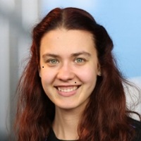
Mia Jukić, Scientist, Netherlands Organisation for Applied Scientific Research (TNO), Netherlands
Accurate positioning is vital for military and civilian operations, but Global Navigation Satellite Systems (GNSS) are increasingly vulnerable to jamming and spoofing. The Magnetic Aided Inertial Navigation System (MAINS) offers a robust alternative, using scalar and vector magnetometers to measure ambient magnetic fields. By comparing these measurements with a pre-established magnetic map, the system could correct errors accumulated by the inertial navigation system. In 2024, two trials were organized in La Spezia, Italy, by NATO CMRE, the University of Pisa, and TNO to evaluate MAINS for maritime application. This presentation showcases the trials, the collected magnetic data, and the performance of a MAINS simulation using said data.
Mia Jukić is a scientist at TNO specializing in electric and magnetic signatures. Her work focuses on quantum magnetic sensing for magnetic navigation and magnetic anomaly detection, supported by expertise in mathematical modeling and numerical simulations.

10.25 – 10:50
Aquaculture robotics research at SINTEF Ocean
Sveinung Johan Ohrem, Research Manager, Aquaculture Robotics and Automation, SINTEF, Norway

The presentation provides an insight into the research and development SINTEF Ocean has conducted in underwater robotics over the past 12 years. We have consistently worked with general methods but have focused on demonstrations and implementation in the aquaculture industry. We see that concepts such as structure-relative navigation and anomaly detection with machine vision have significant transfer potential to sectors like ocean energy production and defense.
To be confirmed.

10.50 – 11.10
Panel Session: Navigating Dual-Use Innovation: Balancing Security, Science, and Sustainability
Speakers: To be confirmed
SESSION 1:
Navigation techniques without access to GPS

12.00 – 12.20
Panel Session: Navigating Dual-Use Innovation: Balancing Security, Science, and Sustainability
Speakers: To be confirmed

12.20 – 12.40
UUV navigation trades
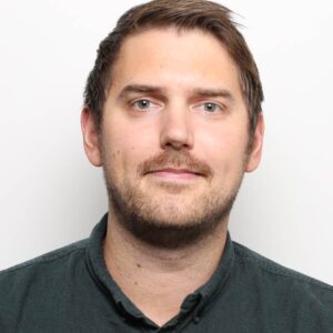
Owen Griffiths, Senior Principal Scientist, Dstl, UK
It is recognised that navigation using GNSS is susceptible to jamming or spoofing. Autonomous platforms, especially small, low cost platforms for which high-grade navigation systems would cause them to be prohibitively expensive need something else to support their navigation. Submerged Underwater Uncrewed Vehicles (UUVs) in particular struggle with availability of Space Weight and Power (SWAP), in addition to having limited access to satellite-based navigation data. This presentation evaluates some of the trades necessary to support navigation of these vehicles, with data to support the analysis.
Owen Griffiths is a Fellow at the Defence Science and Technology Laboratory in the UK. He has a PhD in quantum physics and his research focusses on the understanding of magnetics and magnetic sensing across a wide range of defence, security and geophysical problem sets.

12.40 – 13.00
Magnetic Anomaly Navigation for Aircraft
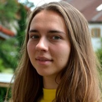
Antonia Hager, PhD Student, Airbus, NTNU Trondheim, Norway
Antonia Hager holds a Master’s degree in Physics from LMU Munich and is a PhD student at Airbus Central Research & Technology and NTNU (Norwegian University of Technology and Science) Trondheim since 2023. She works on airborne magnetic anomaly navigation using quantum sensors.
13.00 – 13.10
Q&A Session
SESSION 2:
Sensors and instrumentation
14.30 – 14.50
A fielded diamond vector magnetometer for Earth and Space
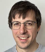
David Roy-Guay, CEO, SBQuantum, Canada
We summarize our progress towards a portable diamond-based quantum magnetometer, leveraging nitrogen-vacancy (NV) centers. Through the MagQuest Challenge to build future versions of the World Magnetic Model, sub-nanotesla sensitivity and vector accuracy has been demonstrated at various magnetic testing facilities. We will detail the magnetometer operating scheme and environmental testing validated operational stability under -30°C to 50°C, high vacuum, and radiation exceeding LEO space mission requirements. The ML based noise compensation of the magnetometer on a magnetically noisy cubesat platform will be presented, achieving nT level of compensated noise. The roadmap for drone integration of the vector magnetometer will detail the next set of performance improvements so that a self compensated tensor gradiometry platform can be provided for minerals exploration.
David is the CEO and founder of SBQuantum, a spinoff from Institut quantique, Sherbrooke, Québec, Canada. After completing his PhD studies on diamond based quantum magnetometry, he led an engineering team to prototype the technology out of the optics labs. SBQuantum’s passage through the Creative Destruction Lab quantum stream has added an algorithmic and data centric focus, to provide to clients the best Magnetic Intelligence for geophysics exploration. Advocate of open innovation challenges to bridge deep tech science to end users, David has lead SBQuantum’s team to the last stages of the MagQuest challenge, leveraging the proprietary quantum technology to build the World Magnetic Model.

14.50 – 15.10
Underwater measurements with quantum magnetometers
Samantha Davidson, Technical Authority, Ultra Maritime SMAP, UK
Underwater detection of magnetic objects is a key area of research in the current maritime environment for both defence and commercial applications. In this poster we report on detection measurements made with quantum Optically Pumped Magnetometers (OPM) in proximity to steel objects in air and in shallow fresh water. Measurements were made in standalone sensor mode as well as using a pair of sensors in a magnetic gradiometer mode. A description of the underwater hardware will be provided. The analysis of the measured background noise including the noise reduction achieved using the gradiometer mode will be illustrated.
Samantha graduated from Oxford University with a BA(Honours) in Physics and then completed a Doctorate in Magnetics at the Clarendon Laboratory. Since joining Ultra, she has led the Ranges product development specialising in electromagnetic modelling algorithms and non-acoustic detection. She is currently Capability Manager for Underwater Ranges and Sensors.

15.10 – 15.30
To be confirmed
15.30 – 15.40
Q&A Session
SESSION 3:
Forward and Inverse modelling, detection and surveys
16.10 – 16.30
Removal of ship magnetic signature from a nearby ROV magnetic survey
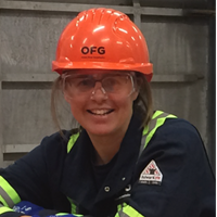
Karen Weitemeyer, Marine Geophysicist, Ocean Floor Geophysics, Inc., Canada
An ROV equipped with HyperMag completed a high resolution (shallow ~130m depth) magnetic survey to map buried seafloor infrastructure. Navigational constraints required the ROV to stay within a 45 degree USBL cone, resulting in about 90 nT of magnetic noise due to the proximity of the ship. To mitigate this the relative positions of the ship and ROV were held constant to maintain the same ship signature. A calculated ship magnetic signature was then used to remove the ship signal from the data. The corrected data was used in an inversion to locate buried seafloor infrastructure.
Dr. Karen Weitemeyer is a Marine Geophysicist at Ocean Floor Geophysics Inc. (OFG) since 2017 and a visiting researcher at the University of Southampton, UK since 2015. She earned her B.Sc (Hon) from the University of British Columbia in Geophysics, and PhD from Scripps Institution of Oceanography.

16.30 – 16.50
Magnetic Signature Reduction and Management on a New Rescue and Salvage Vessel
Pawel Polanski, Chief Specialist Physicist, R&D Marine Technology Centre (CTM), Gdynia, Poland
Paper presents insights into the design of magnetic reduction and management system for a new rescue and salvage vessel for the Polish Navy (PN). Modern Degaussing systems (DG) for ships with ferromagnetic hulls are new to PN. Invaluable experience was gained during the ongoing construction of the Kormoran II class Mine Hunters (MH). Measurement range considerations are also included basing on newly developed portable multi-influence underwater range.
Results of the performed works confirm design assumptions and chosen solutions and allow prediction that required level of magnetic signature reduction on auxiliary vessels will be met and successfully measured.
Keywords: underwater signature, magnetic field, degaussing system, physical scale model, ferromagnetic hull, underwater signature range.
Paweł Polański, physicist, was a PM of Signature management system for two MH ships and of the sweep systems for BE and NL rMCM programme. Currently involved as physicist and tech lead in multiple areas connected with underwater signatures, especially magnetic and electric, from ships through sweeps to mines and critical infrastructure protection.
16.50 – 17.00
Q&A Session
SESSION 4:
Critical Underwater Infrastructure
10.00 – 10.20
SPARSE: Cost-Effective Geophysical Monitoring for Long-Term CO₂ Storage
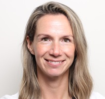
Madeline Dana Lee, Research Scientist, SINTEF, Norway
We present SPARSE (Sparse Passive-Active Reservoir monitoring using Seismic, Electromagnetics, gravity, and surface deformation) for low-cost, long-term CO₂ storage monitoring. Carbon capture and storage sites require decades of precise monitoring post-injection. SPARSE uses sparse, repeatable geophysical data from strategically placed seabed or land nodes to ensure CO₂ containment and conformance with predictive models via forward and inverse modelling and testing. Focused on Canada and the Norwegian Continental Shelf, we investigate optimized survey designs for reliable data collection, addressing environmental and communication challenges while achieving cost efficiency.
Madeline Lee is a research scientist in the Geophysics Group at SINTEF Applied Geosciences in Norway. Her expertise includes airborne geophysics and geophysical modelling, with specializations in magnetics and uncrewed aerial systems. Her research focuses on geohazards, dual-use technologies, critical infrastructure, and green energy transition.

10.20 – 10.40
CEDAR sensing technology : enhancement and qualifications with NATO
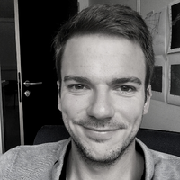
Gary Bagot, Sales Director, Elwave, France
At the end of 2023, Elwave launched its subsea product range of compact active/passive electromagnetic sensors, which includes the Octopulse (8 electrodes) and Tetrapulse (4 electrodes). These sensors provide real-time complex impedance measurements (amplitude and phase) to generate live seabed resistivity maps, seabed target electrical images, or to detect living targets in the water column. This presentation will describe the physical principles of the biomimetic sensing technology CEDAR (Controlled Electric Detection and Ranging) and several demonstration operations conducted worldwide from multiple subsea vehicles over targets, such as mines, UXO, pipelines, cables, and persistent deployment for intruder detection.
Gary Bagot started his career with the French Navy and later spent 10 years in the oil and gas industry survey operations, initially working for Boskalis and then Technip. Gary later became Inertial Product Manager at Exail and is now the Sales Director at Elwave.

10.40 – 11.00
A Lightweight, ROV-Mounted System for the Early Detection of Marine Infrastructure Corrosion
Florent Colin, Senior R&D Engineer, MAPPEM Geophysics
Cathodic protection systems are designed to prevent the corrosion of metal surfaces and commonly applied to steel structures such as pipelines and other maritime infrastructure. MAPPEM, in collaboration with project partners, has successfully developed an innovative lightweight ROV-mounted system for cathodic protection monitoring. The system measures 3D electromagnetic fields to detect anodes and defaults, and any potential corrosion processes. MAPPEM’s instrument is designed for easy integration with small inspection ROVs, ensuring convenient deployment and operation. This presentation will introduce an outline of the system and results from various tests conducted on pipe samples in different stages of corrosion.
Florent Colin is a Senior R&D Engineer at MAPPEM Geophysics. He leads MAPPEM’s global electromagnetic measurement campaigns. He drives innovation at MAPPEM, combining his PhD in geophysical data processing from Ifremer with an MSc from EOST. His expertise spans both theoretical research and practical field applications.
11.00 – 11.10
Q&A Session
SESSION 5:
Forward and Inverse modelling, detection and surveys

12.00 – 12.20
Underwater electric field sensing by a sea creature and the mathematical model of its target detection signal processing
Megumi Hirota, Representative, Naval Ship M&UEP R.C, Japan
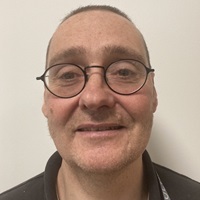
Some sea creatures possess electroreceptors on their skin which enable them to detect nearby targets. These electroreceptors are particularly abundant in hammerhead sharks, which have up to 400 receptors on their heads. Bullock measured their sensitivity using physiological methods and determined it to be approximately 1 μV/m. In this study, we developed a mathematical model of a circular array of electroreceptors to simulate a shark’s hunting process in a uniform electric field, specifically targeting a lipid sphere. During the shark’s characteristic yawing head behavior while hunting, a proper pair of the electroreceptor detect a target by suppressing background noise.
Dr. Megumi Hirota is a research physicist and the Representative of the Naval Ship M&UEP R.C., a non-profit organization. She earned her D. of science in 1981, and subsequently she conducted magnetic detection research at the TRDI, MOD Japan. Her current research focuses on small-scale experiments involving underwater electric-field sensing.

12.20 – 12.40
Coating Loss Localisation and Signature Forward Prediction
Paul Gordon Rawlins, Research Authority, Ultra Maritime, UK
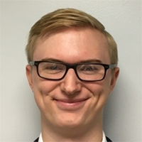
In order to assess the risk from detection due to corrosion related signatures it’s necessary to be able to accurately predict them, therefore, it is essential to describe the current paths between the anodes and cathodes. In general, the locations of the anodes and some cathodes, such as the propellers, are known. However, the location of the coating loss patches, are not known, thus it is necessary to determine a methodology that can localise them.
The purpose of this paper is to describe methodologies for calculating corrosion related signatures and localising coating loss patches from measured data. It will be shown how measurements of the platform’s corrosion state can be employed to infer the location of cathodes, and hence inform the corrosion related signature calculations. Synthetic and physical scale model data will be utilised to demonstrate the coating loss localisation method and inform on its accuracy.
Paul Rawlins is an expert in mathematical physics and algorithm development and has worked as a researcher at Ultra Maritime for over 25 years. His research has focused on the numerical modelling, system design and development of control algorithms for the management of corrosion and electromagnetic signatures for Naval platforms. He is a recognised national and international subject matter expert in modelling and the control of electromagnetic and corrosion related signatures.

12.40 – 13.00
Electric Signature Modelling for Corrosion Monitoring and Forward Prediction
Laurence Deakin, Research Scientist, Atlas Elektronik, UK
Over time, a vessel hull will experience corrosion which leads to the flow of ionic current via the sea water and an E-field associated with the vessel. This work implements a technique to monitor the corrosion of a vessel and localise regions of coating degradation by analysing the in-water E-field and electrochemical potential over the hull surface. To fully characterise the corrosion state, a series of perturbations about the vessel’s ICCP on state are used. With environmental data, this characterisation is modified and used to predict the corrosion state and electric signature of the vessel in a forward environment.
Laurence Deakin has been a research scientist at Atlas Elektronik UK for the past two years, following graduation of the MPhys (Physics with Space Science) degree from the University of Southampton. His current interests include data analysis and algorithm development, with a focus on electric signatures of maritime platforms.
13.00 – 13.10
Q&A Session
SESSION 6:
Forward and Inverse modelling, detection and surveys
14.30 – 14.50
An electromagnetic investigation the continent-ocean transition southwest of the UK
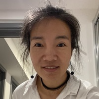
Yuan Li, Research Fellow, University of Southampton, UK
In ocean-continent transition zones at rifted continental margins, it is important to distinguish between crustal rocks and hydrated mantle rocks and between continental and oceanic mantle. Fortunately these materials have different resistivities. We deployed 51 seafloor instruments across the ocean-continent transition at the Goban Spur rifted margin southwest of the UK and to recorded both magnetotelluric and controlled source electromagnetic data. Our transmitter used a fundamental frequency of 0.25 Hz and had a dipole moment of 30000 A.m. We are using the resulting dataset, along with coincident seismic data, to explore the nature of continental breakup at this margin.
Yuan Li has been a research fellow at the University of Southampton since July 2024. Yuan started working on CSEM data analysis during her PhD at the China University of Geoscience Beijing. More recently she was a visiting professor at TU Delft in 2021, working on modelling of CSEM data.

14.50 – 15.10
Sensitivity of CSEM Response for Monitoring CO2 Plumes Using Wellbore Infrastructure
Madeline Dana Lee, Research Scientist, SINTEF, Norway
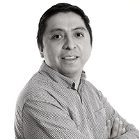
This study investigates the potential of utilizing existing well infrastructure in marine CSEM for efficient CO2 storage monitoring, focusing on detecting and characterizing deep CO2 plumes, with applications to Aurora and Smeaheia storage sites. Analysing EM signals from well casings excited by a seafloor dipole, we use FEM simulations to assess the sensitivity of seafloor-measured E-fields to variations in plume geometry and depth. Results reveal a complex interplay between EM fields, CO2 distribution, formation layers, and plume depth, demonstrating that seafloor signals contain valuable information about subsurface CO2 spatial distribution and vertical extent. This method offers a promising approach for enhanced CCS monitoring.
Madeline Lee is a research scientist in the Geophysics Group at SINTEF Applied Geosciences in Norway. Her expertise includes airborne geophysics and geophysical modelling, with specializations in magnetics and uncrewed aerial systems. Her research focuses on geohazards, dual-use technologies, critical infrastructure, and green energy transition.

15.10 – 15.30
Exascale-driven advances in geo-electromagnetic imaging
Octavio Castillo-Reyes, Assistant Professor/Researcher, Universitat Politècnica de Catalunya / Barcelona Supercomputing Center, Spain
The advent of computational geosciences has profoundly transformed geophysical imaging, with electromagnetic (EM) methods serving as a cornerstone for resource exploration and environmental modeling. In the Exascale era, achieving faster and more precise data is within reach; however, significant challenges persist in addressing scalability, fault tolerance, and the development of advanced computational methodologies. Europe is at the forefront of this effort through substantial investments in EuroHPC (Euro high-performance infrastructure) infrastructures such as LUMI and MareNostrum-V. This conference highlights the development of EM imaging kernels optimized for Exascale computing and promotes multidisciplinary collaboration between academia and industry to advance sustainable geoscience solutions.
Octavio Castillo-Reyes, a professor at UPC and researcher at BSC, specializes in numerical methods for geo-electromagnetic modeling using parallel computing. He holds a PhD (Cum Laude) from UPC, is a CONACyT Level I researcher, a Mexican Supercomputing Network member, and ANECA/AQU-certified in Spain.
15.30 – 15.40
Q&A Session
SESSION 7:
Sensors and instrumentation

16.10 – 16.30
Introducing the TD15, a new time domain metal detector system with high output Tx and large Rx array capability
Markus Svilans, President, Aeonyx Research Corporation, Canada
Aeonyx Research has developed a new time domain (pulse induction) electromagnetic metal detector survey system, called the TD15 Receiver Array System. The TD15 system is currently operating in Canada for UXO survey and clean-up. TD15 incorporates numerous important features, including a high output EM transmitter, up to 15 receive antennas, and 24-bit simultaneously sampled ADCs. Being simple to operate, lightweight and compact, TD15 can be used in a broad range of requirements and applications. We wish to introduce the TD15 technology to the Marelec community, with the intent to explore collaboration opportunities to adapt TD15 to marine applications.
Markus is co-founder at Aeonyx Research, an R&D company in Ontario, Canada. Markus holds a B.Sc. (Honours) in Computational Geophysics from Carleton University (Canada). Past work includes airborne geophysics and VLF communications. Current focus is on the design and development of new metal detector instruments.

16.30 – 16.50
Evaluating uncrewed aerial vehicle aeromagnetic calibration performance using neural networks at low altitude
Dr Loughlin Tuck, Defence Scientist, Defence R&D Canada, Canada
Aeromagnetic compensation has historically been done at high altitudes where geological signal does not interfere with aircraft manoeuvre noise. An issue with uncrewed aerial vehicles is that they can be limited to low latitudes due to power or regulatory restrictions. This presentation will discuss the problem and provide a case study of a UAV successfully compensated using a trained neural network where a standard Tolles-Lawson method failed.
Dr. Loughlin Tuck, P.Eng received a B.A.Sc. (2003) and a M.A.Sc. (2005) in Engineering Physics from Queen’s University in Kingston, ON, Canada, a M.Sc. (2015) in Geology from Laurentian University in Sudbury, ON, Canada and a Ph.D. (2019) in Earth Science (Geophysics) from Carleton University in Ottawa, ON, Canada. His research is in the development of sensors and quantum technology for airborne platforms particularly for magnetic anomaly detection (MAD), geoscience, and positioning, navigation, and timing (PNT) applications.

16.50 – 17.10
Magnetic Anomaly Detection (MAD) using 2D pattern recognition approach for marine applications
Arie Sheinker, Head of Magnetic Sensing Group, Soreq NRC, Israel
Magnetic anomaly detection is used for detection of visually obscured ferromagnetic objects. Marine applications include surveys aiming to detect ship wrecks, UXO and archaeological artifacts. Detection based on a single survey line may lead to high FAR.
Dr. Arie Sheinker is the head of the magnetic sensing group at SOREQ NRC. His current research focuses on precise magnetic measurements and magnetic signal processing including:
magnetic anomaly detection, magnetic navigation, magnetic noise filtering and interference cancellation.
17.10 – 17.20
Q&A Session
SESSION 8:
Forward and Inverse modelling, detection and surveys
10.00 – 10.20
Autonomous ROV-based 3D Electromagnetics for Seabed Target Classification
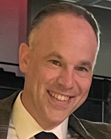
Gregory Schultz, Chief Technology Officer, White River Technologies, USA
Subsea environmental and defense applications require the detection, geo-registration, and characterization of man-made targets on/below, the seafloor. In this work, we are demonstrating a highly-integrated and autonomous underwater vehicle-based 3D electromagnetic induction (3DEM) technology. Dense clutter, object burial, and marine growth challenge the detection and classification of objects such as UXO, pipes, and cables. Inspection-class ROVs along with existing uncrewed surface vehicles implement operational workflows for mapping and classification. When tightly controlled and integrated with subsea navigation systems, 3DEM quantifies location, size, material composition and shape of seabed objects. We present results from multiple at-sea demonstrations in North America.
Dr. Gregory Schultz is the Chief Technology Officer at White River Technologies. He conducts R&D in marine geophysics to develop and transition magnetic and electromagnetic sensor systems for military and environmental applications. Current research includes marine EM, target recognition and machine learning, autonomous sensing systems, and magnetic inversion and navigation.

10.20 – 10.40
Calibration of shipborne vector magnetic data for mapping and detection surveys, main results and prospects of MAGIDRO research project
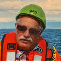
Jean-Francois Oehler, Marine Geophysicist, Shom, France
The MAGIDRO research project, with partners Hydrographic and Oceanographic Agency of the French Navy (Shom) and ITES laboratory of the University of Strasbourg (France), has reached its conclusion after four years of work dedicated to marine magnetometry. In this presentation, we illustrate how the technique using embedded vector sensors generally deployed on UAV on terrestrial applications has been successfully transposed to marine carriers. Our research covers the whole magnetic data acquisition and processing chain: synthetic tests, methodological developments on data acquisition, calibration to remove carrier effects, post-processing and trials at sea on coastal and deep-sea ships as well as on drones (UAV, UUV and USV). Results now offer a wide range of future opportunities in mapping and detection surveys, for civilian and military purposes.
Jean-François is in charge of research in geomagnetism at the department of Marine Geophysics of Shom, the Hydrographic and Oceanographic Service of the French Navy. His research interests focus on improving methodologies for the acquisition, processing and modeling of marine magnetic data for civilian and military applications.

10.40 – 11.00
ROV aided CSEM surveys for Seafloor Massive Sulfide (SMS) exploration
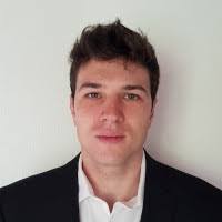
Peter Kowalczyk, Senior Consulting, Geophyiscist, Ocean Floor Geophysics, Inc., USA
CSEM is an established method to rank SMS targets. However, the logistics and cost of an SMS CSEM survey is complicated due to rugged terrain in deep water, variable target geometry and the difficulties of placing and navigating a CSEM transmitter and receiver. An ROV can aid transmitter placement and can be used as the electric and magnetic receiver platform. Accurate transmitter placement and navigation of both transmitter and receivers optimizes the detectability of targets and optimizes signal to noise for a given transmitter moment. EH3D (UBC-GIF) is used to model different transmitter types and survey layouts. Costs are reduced.
Peter Kowalczyk is a founder of Ocean Floor Geophysics Inc. (OFG). He obtained a B.Sc. (geophysics) from the University of British Columbia in 1970 and has worked worldwide in mining and marine minerals exploration throughout his career. Before OFG he was Chief Geophysicist of a major mining company.

11.00 – 11.20
Reflections on multipole modelling for magnetic anomaly detection
Clément Chenevas-Paule, PhD Student, Naval Group, France
Many magnetic anomaly detection (MAD) systems are based on a physical modeling of the source, usually approximated by a magnetic dipole. This model is accurate when the sensor is far from the source. In the other case, higher orders may have a non-negligible influence on the measured signal, so modelling the source as a multipole may lead to an improvement of detection schemes. While such a generalization provides a finer representation of the anomaly, it also raises new questions and challenges (e.g. multipolar basis orthonormalization, signal representation space, choice of the signal order), that will be discussed in this work.
Clément Chenevas-Paule is an applied mathematics engineer from Ensimag (Grenoble, France) and is doing a joint PhD between G2Elab/GIPSA-LAB and Naval Group on electromagnetic detection of underwater sources.
11.20 – 11.30
Q&A Session
SESSION 9:
Forward and Inverse modelling, detection and surveys
12.00 – 12.20
Validation of Numeric Modelling Techniques for Degaussing Systems in Ferromagnetic Vessels.
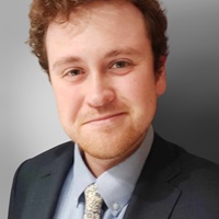
William Edward Somerset, Scientist, Ultra Maritime, UK
Reduction of a vessel’s ferromagnetic signature is important for the avoidance of mine and detection threats, predominantly achieved through use of onboard degaussing (DG) coils to produce counteracting fields. In this work, the use of finite element models to predict the induced magnetisation and in-steel DG coil effect measurements of a steel physical scale model to a high degree of accuracy is reported. In this way, synthetic data can be used to inform reliable inverse and forward source models for DG systems and may be used to accurately generate magnetic signatures of realistic vessels.
Will Somerset is a research scientist at Ultra Maritime specializing in the numerical modelling of degaussing systems for Naval platforms. He has previous research experience in industrial ultrasound systems and acoustic metamaterials during his physics Ph.D. (University of Warwick) and post as research associate (University of Bristol).

12.20 – 12.40
Simultaneous estimation of marine electromagnetic signatures and relative sensor-vessel geometry
Benjamin Thomas, Senior Resarch Engineer, Atlas Elektronik, UK
Electromagnetic signatures of naval vessels are typically measured by transiting the vessel over seabed sensors. Conventionally, a two-step process is followed; firstly, the time-variant sensor-vessel geometry is estimated; secondly, the sensor measurements are inverted for a mathematical model representing the signature’s source. While simple, this sequential strategy incompletely exploits the available information and risks sensor-vessel geometry errors being propagated into source model errors. In this presentation, a one-shot approach to inversion is described, where simultaneous estimation of the sensor-vessel geometry and electromagnetic signature results in improved attribution of errors to their respective sources, hence improving the accuracy of electromagnetic signature estimates.
Ben is a senior research engineer at Atlas Elektronik UK with an interest in inverse problems and algorithm development. His current work focuses on the prediction, measurement, and control of the magnetic signatures of naval platforms.

12.40 – 13.00
Estimation of multipolar equivalent surface source model error for near field identification
Gauthier Derenty-Camenen, Consultant, DGA TN, France
Mr Gauthier Derenty-Camenen has begun his PhD at G2ELab (Grenoble Electrical Engineering Laboratory) and GIPSA-Lab (Grenoble signal processing laboratory) in 2021 on the use and alteration of spherical harmonic models for non-spherical objects.
13.00 – 13.20
Q&A Session
13.20
CONFERENCE CLOSING REMARKS FROM CONFERENCE CHAIR
